Hiking to the summit of La Soufrière
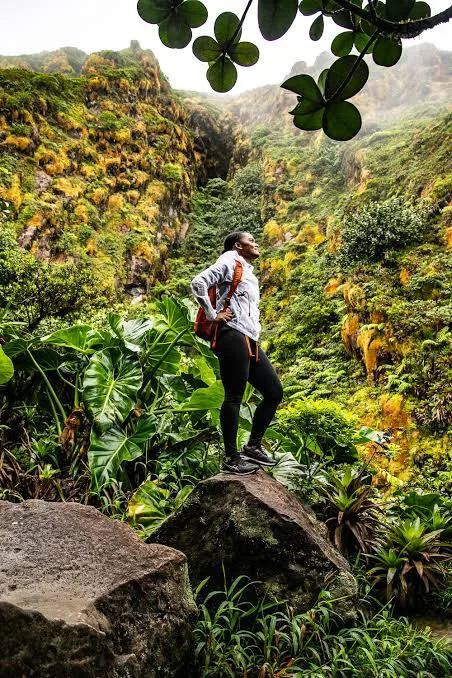
La Soufrière, an active volcano rising to 1,467 metres, is the highest point of the Lesser Antilles and Guadeloupe’s signature hike. From Basse-Terre, the trailhead is in the hills of Saint-Claude, so you can be at the foot of the volcano early in the morning, the best time for views.
Start: Bains Jaunes car park
The most popular trail starts at the Bains Jaunes car park in Saint-Claude, above Basse-Terre. The paved “Pas du Roy” path first crosses the rainforest before the vegetation thins out near the dome.
Duration and difficulty
Allow roughly 3 to 5 hours return depending on your pace. The climb is steady and steeper at the end; it requires good fitness but no technical skills.
Parts of the summit may be closed depending on volcanic activity: check with Guadeloupe National Park before you go.
Weather: start early
The summit is very often in the clouds, windy and wet, sometimes with only a few metres of visibility. Your best chance of a clear view is early in the morning. The trail is often muddy and slippery.
What to bring
Good hiking shoes, a waterproof windbreaker and a warm layer, water, snacks and a change of clothes. An offline map app is useful in fog.
After the hike
On the way back, a soak in the warm Bains Jaunes pool next to the car park is the perfect reward. You will be back at Les Terrasses du Fort in under half an hour to enjoy the sea view.
Frequently asked questions
How long does the Soufrière hike take?
Allow 3 to 5 hours return from the Bains Jaunes car park, depending on pace, weather and trail conditions.
What time should I start?
As early as possible: clouds often cover the summit later in the day.
Is the summit always open?
No, some areas may be closed depending on volcanic activity. Check Guadeloupe National Park information before you go.